
Special Areas Environmental Reports (ER)

Special Areas Environmental Reports (ER) are reports that provide information about potential environmental impacts that may occur from development or activities in certain designated areas. These designated areas may include protected areas, such as national parks or wildlife reserves, or areas that have been identified as having high ecological, cultural or social significance.
The main objective of an Environmental Report is to identify and assess the potential environmental impacts of proposed activities or development. This includes quantifying the nature and extent of impacts, identifying potential risks to human health and safety, and suggesting mitigation measures to minimize the environmental impact.
ERs are usually required as part of a regulatory process, such as an Environmental Impact Assessment (EIA) or Environmental and Social Impact Assessment (ESIA), which must be completed before certain activities or developments can proceed.
Our environmental staff are trained in environmental impact assessments and understand the relevant regulatory framework and local context.
Key sections of an ER may include an explanation of the proposed activities or development, a description of the current environment, an assessment of the potential impacts of the proposed activities or development, and recommendations for mitigation measures to reduce the potential impacts.
First Nation Consultation

First Nation consultations are a critical part of promoting reconciliation and the recognition of Indigenous rights in Canada, and they are an important tool for ensuring that development projects and activities are carried out in a manner that respects and protects the rights and interests of First Nations. CWP Environmental professionals can assist you with these consultations.
Timber Evaluation Surveys

Timber evaluation surveys assess the quality and quantity of timber resources in a particular area. Our forestry professionals help landowners or managers make informed decisions about managing and harvesting timber resources.
During a timber evaluation survey, our forestry professional will typically assess the age, species, and overall health of trees in the area, as well as factors such as stand density, site productivity, and soil quality. This information is used to estimate the volume and value of the area’s timber resources and identify any potential risks or issues that may need to be addressed.
The results of a timber evaluation survey can be used to inform decisions about whether and when to harvest timber resources, what methods to use for harvesting, and how to manage the area in the future to ensure sustainability and continued productivity. The survey can also help landowners or managers determine the potential revenue that can be generated from timber sales and can be used to negotiate contracts with timber buyers.
Overall, timber evaluation surveys are essential for ensuring that timber resources are managed sustainably and that landowners or managers can make informed decisions about using and managing their timber resources. Our professional forestry staff members are here to assist you.
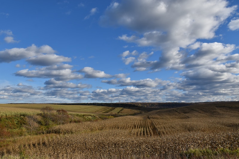
Ecosite Classification

Ecosite classification is a system used in forestry to classify and describe different ecosystems or forest sites based on their physical and biological characteristics. This classification system is used to understand the ecological aspects of varying forest areas and guide forest management and conservation decisions.
The ecosite classification system typically considers soil type, vegetation composition, climate, topography, and hydrology factors. By analyzing these factors, we can determine the unique ecological characteristics of a particular area and assign it to a specific ecosite class.
Each ecosite class is associated with ecological attributes, such as tree species composition, stand productivity, and nutrient cycling, and a set of management recommendations tailored to that class’s specific characteristics. This information can be used to develop forest management plans that aim to maintain or enhance the ecological integrity of different forest sites.
Ecosite classification can also be used to identify areas of a forest that are particularly sensitive to disturbance or are of high conservation value, such as areas with rare or endangered species or essential habitat features. This information can guide conservation efforts and prioritize areas for protection.
Overall, ecosite classification is an essential tool for understanding the ecological characteristics of different forest sites and for developing forest management plans that balance ecological, social, and economic objectives.
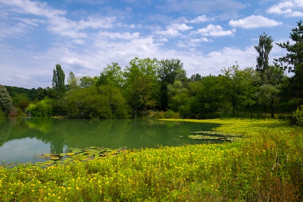
Watercourse Crossing Assessment

Watercourse crossing assessment evaluates the potential impacts of a proposed infrastructure project on a watercourse, such as a river, stream, or wetland and develops measures to mitigate those impacts. The goal of the assessment is to ensure that the project does not cause significant harm to the aquatic ecosystem or the safety and stability of the infrastructure.
Our assessments typically involve a thorough study of the watercourse’s physical, biological, and chemical characteristics, as well as an evaluation of the project’s potential impacts on water quality, aquatic habitat, and the natural flow of the watercourse. This information is used to develop mitigation measures that can be incorporated into the project design to reduce the impacts to an acceptable level.
Mitigation measures may include installing culverts or bridges to maintain the natural flow of the watercourse, implementing erosion and sediment control measures to protect water quality, or establishing buffer zones around the watercourse to preserve sensitive habitat. The watercourse crossing assessment process typically involves consultation with regulatory agencies, stakeholders, and the public to ensure that all concerns and perspectives are considered.
It is an essential step in planning and designing infrastructure projects that cross watercourses and can help minimize the environmental impacts of those projects while ensuring their safety and effectiveness.
Conservation Operation Reclamation Plans (CORP)
Conservation Operation Reclamation Plans (CORPs) are plans that are developed to ensure the effective and sustainable management of natural resources in mining operations. Specifically, a CORP outlines the measures that will be taken to mitigate the environmental impacts of a mining operation and to reclaim the land for its original intended use after the mining is completed.
Our process of developing a CORP typically involves a comprehensive assessment of the environmental impacts that the mining operation is likely to have and an evaluation of the potential risks and hazards associated with the operation. Based on this assessment, the plan will outline specific measures that will be taken to minimize these impacts and to reclaim the land once mining has been completed.
These measures may include things like implementing erosion and sediment control measures to protect water quality, establishing buffer zones around sensitive habitats, and planting vegetation to stabilize slopes and prevent soil erosion. The plan may also include measures to monitor and manage the environmental impacts of the operation throughout its lifespan.
Regulatory agencies typically require CORPs as part of the permitting process for mining operations. They are an important tool for ensuring that mining operations are conducted in an environmentally responsible and sustainable manner and that the land is restored to a condition that is suitable for its original intended use once mining has been completed.
Permafrost Protection Plan (PPP)

Permafrost Protection Plans (PPPs) are developed to mitigate the impacts of infrastructure development on permafrost, which is permanently frozen soil found in Arctic and sub-Arctic regions. PPPs aim to preserve the stability of the permafrost and prevent it from thawing, which can result in significant environmental and economic impacts.
Developing a PPP typically involves a comprehensive assessment of the permafrost in the project area, including its thickness, depth, and temperature. The plan will then outline specific measures that will be taken to minimize impacts to the permafrost during the construction and operation of the infrastructure.
These measures may include minimizing site disturbance and the amount of heat generated by the infrastructure, such as using insulation or cooling systems. The plan may also include steps to monitor the permafrost for changes in temperature or stability and to take action, if necessary, to prevent damage or degradation.
Regulatory agencies typically require PPP’s as part of the permitting process for infrastructure development in permafrost regions. They are an important tool for ensuring that infrastructure development is conducted in an environmentally responsible and sustainable manner and that the stability and integrity of the permafrost are preserved for future generations.
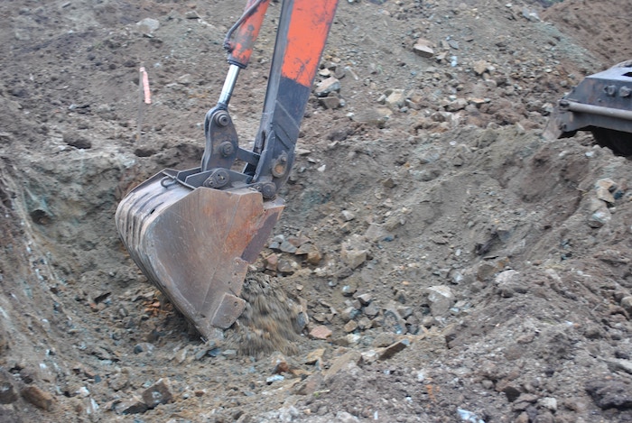
Remote Sump Soil Sampling
Remote sump soil sampling collects soil samples from a remote sump location, typically in the oil and gas industry. A sump is a pit or reservoir designed to collect fluids, such as oil or water, that may have leaked or spilled from equipment.
Our remote sump soil sampling involves using specialized equipment and techniques to collect soil samples from a sump location without needing to access the site physically. This is important because sump locations can often be located in remote or difficult-to-access areas, and accessing them can be hazardous or environmentally damaging.
The remote sump soil sampling equipment typically includes a specialized soil sampler, such as a hydraulic or pneumatic piston sampler, which can be operated remotely. The sampler is typically lowered into the sump using a cable or other remotely operated lifting device. Once the sampler reaches the desired depth, it is triggered to collect a soil sample, which is then lifted back to the surface for analysis.
Remote sump soil sampling is an essential tool for environmental monitoring and assessment in the oil and gas industry, as it allows for collecting soil samples from potentially contaminated locations without the need for extensive site preparation or physical access. It can be used to assess the extent of contamination in a sump location, to identify potential environmental risks, and to inform remediation efforts if necessary.
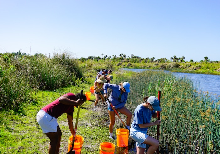
Rare Plant Surveys

Rare plant surveys are conducted to identify and assess populations of plant species that are considered rare, threatened, or endangered. Our trained botanist professionals typically conduct these surveys and involve a systematic search of a particular area to locate and identify rare plant species.
The goal of a rare plant survey is to identify the location and extent of rare plant populations, as well as to assess the health and viability of those populations. This information is important for conservation efforts, as it can help to inform management strategies and prioritize conservation actions for rare plant species.
Rare plant surveys typically involve a combination of fieldwork and data analysis. Fieldwork may include a visual search of the area and the collection of plant specimens for identification and analysis. Data analysis may involve using statistical models to estimate the size and distribution of rare plant populations and assess the potential impacts of environmental factors, such as climate change or habitat fragmentation, on those populations.
Rare plant surveys are important as they provide critical information for developing management plans and conservation strategies. They can help to identify areas of high conservation value, prioritize conservation actions, and track the success of conservation efforts over time.
Private Land Checklist (PLC)
Private Land Conservation (PLC) refers to the voluntary efforts of private landowners to protect and conserve natural resources on their properties. It is a form of conservation carried out by private individuals or organizations rather than government agencies.
PLC involves implementing conservation practices and management techniques on private lands, including protecting wetlands, forests, grasslands, and other natural habitats. These practices may include habitat restoration, reforestation, invasive species control, and sustainable agriculture practices.
Private landowners who participate in PLC programs often do so because they are interested in conserving natural resources or recognize the ecological and economic benefits of doing so. In some cases, they may also receive financial incentives or tax benefits for their conservation efforts.
Overall, PLC plays a vital role in protecting and preserving natural resources and promoting sustainable land use practices. By engaging private landowners in conservation efforts, PLC can help expand the scope of conservation efforts beyond public lands and provide additional protection for critical natural habitats and species.
Project Proposal & Restoration Plans
Our project proposal for restoration plans is a document that outlines a comprehensive plan for restoring and rehabilitating natural habitats or ecosystems that have been degraded or damaged by human activities or natural disasters. The proposal typically includes detailed information about the project’s objectives, scope, timeline, budget, and expected outcomes.
The restoration plan may include various activities such as site preparation, planting of native vegetation, removing invasive species, erosion control, and monitoring progress. Our proposals address environmental impact assessment, community engagement, and stakeholder consultation.
Our proposal should be based on a thorough analysis of the site and its ecological condition and an understanding of the ecological processes and functions that need to be restored. Our analysis is informed by scientific research and monitoring data to ensure that the proposed restoration activities are appropriate for the site and will achieve the desired outcomes.
Our restoration plan will also consider the long-term sustainability of the restored ecosystem and include measures to maintain the restored ecosystem over time. This may involve ongoing monitoring and management activities and engagement with local communities and stakeholders to ensure their support and participation in the restoration efforts.
Our well-crafted project proposal for restoration plans is essential for securing funding and support for the restoration project and ensuring that the restoration activities are effective, sustainable, and beneficial for the environment and the local community.
Environmental Protection Plans (EPP)

Our Environmental Protection Plans (EPPs) are comprehensive documents that outline measures and strategies for preventing, mitigating, and managing the environmental impacts of a particular project or activity. Our EPPs are typically developed as part of the environmental assessment process for projects in many industries, including mining, oil and gas, construction, and forestry.
An EPP aims to ensure that a project or activity is designed and implemented to minimize adverse environmental impacts and comply with relevant environmental regulations and standards. EPPs typically include a range of measures to protect the environment, such as the following:
- Environmental impact assessment: This involves identifying and assessing the potential environmental impacts of the project or activity and potential risks and uncertainties.
- Mitigation measures: This involves identifying and implementing measures to minimize or avoid adverse environmental impacts, including efforts to prevent, minimize, or mitigate impacts on water quality, air quality, wildlife, vegetation, and cultural resources.
- Monitoring and reporting: This involves establishing a monitoring program to track the implementation of the EPP and the effectiveness of mitigation measures and reporting on environmental performance to regulatory agencies and stakeholders.
- Contingency planning: This involves developing contingency plans to address potential environmental emergencies, such as spills, releases, or other incidents that may cause harm to the environment.
- Stakeholder engagement: This involves engaging with stakeholders, including local communities, Indigenous groups, and other interested parties, to ensure that their concerns and perspectives are taken into account in the development and implementation of the EPP.
Our EPP ensures that projects and activities are designed and implemented to protect the environment and minimize adverse impacts. By identifying potential environmental risks and implementing appropriate measures to mitigate those risks, EPPs can help to ensure that projects are sustainable and socially responsible.
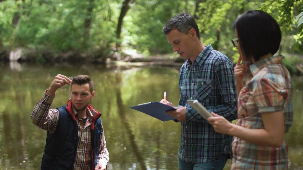
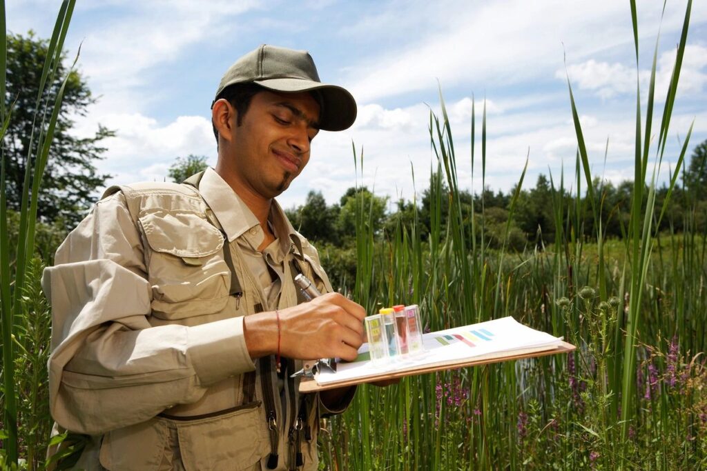
Environmental Field Report (EFR)
Our Environmental Field Report (EFR) is a document that provides a detailed account of the environmental conditions and impacts observed during a field assessment or survey. EFRs are typically prepared as part of environmental impact assessments, ecological studies, or environmental monitoring programs.
The objective of our EFR is to provide a clear and concise summary of the environmental conditions and impacts observed in the field, including the following:
- Physical environment: This includes a site description, topography, geology, soils, hydrology, and climate.
- Biological environment: This includes a description of the plant and animal species observed on the site, as well as their abundance, distribution, and habitat requirements.
- Environmental impacts: This includes assessing the potential environmental impacts of the project or activity being considered, as well as any effects observed on the environment, such as soil erosion, water pollution, or habitat loss.
- Mitigation measures: This includes a description of any actions that have been implemented or proposed to mitigate the environmental impacts of the project or activity.
- Recommendations: This includes additional monitoring or assessment and suggestions for further mitigation measures or changes to the project or activity.
Our EFRs typically include detailed maps, photographs, and other visual aids to help illustrate the environmental conditions and impacts observed in the field. They are essential for documenting and communicating the results of environmental assessments and monitoring programs and ensuring that projects and activities are designed and implemented to protect the environment.
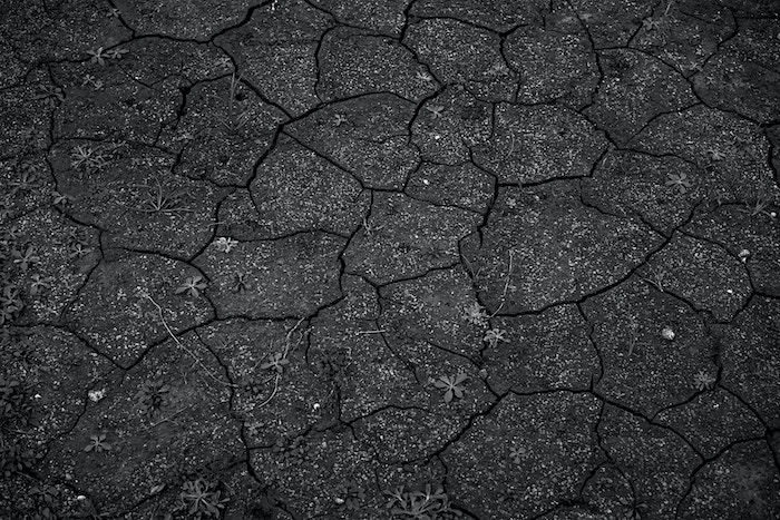
Topsoil and Vegetation Surveys
Our topsoil and vegetation surveys are critical tools in assessing the health and quality of soil and vegetation in a particular area.
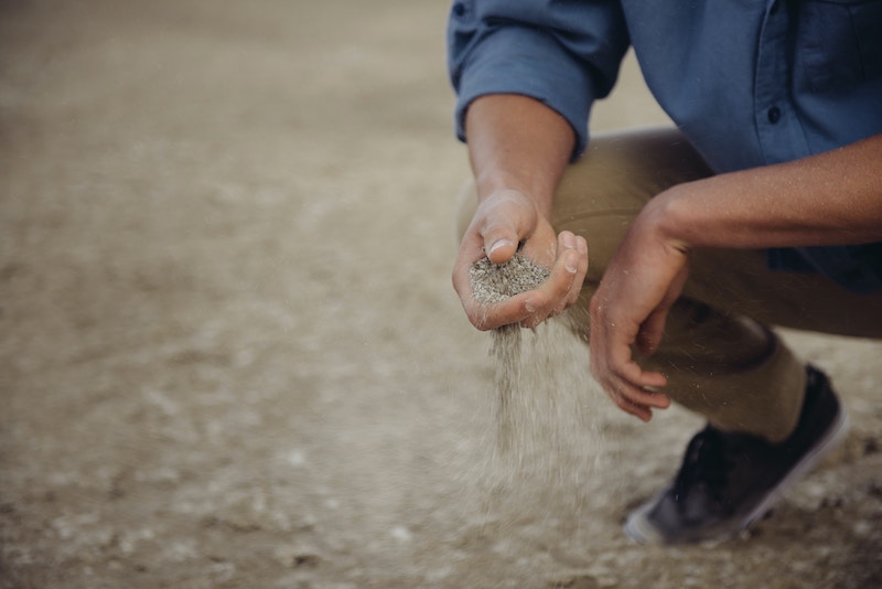
Our topsoil surveys involve collecting and analyzing soil samples from the top layer of soil, typically the top 10-30 cm. The samples are analyzed for various properties such as texture, nutrient content, pH, organic matter content, and potential contaminants. This information can be used to evaluate the quality of the soil and identify any issues that may be impacting plant growth and ecosystem health.
On the other hand, our vegetation surveys involve identifying and assessing plant communities in a particular area. This can be done by visually inspecting the vegetation or collecting plant specimens for further analysis. The information gathered from vegetation surveys can be used to assess the diversity of plant species, individual plants’ health, and the ecosystem’s overall health.
Both topsoil and vegetation surveys are essential tools in environmental management and conservation. Land managers can make informed decisions about land use practices and conservation strategies that promote healthy ecosystems and sustainable land use by understanding the soil quality and the vegetation’s health in a particular area.
Biophysical Impact Assessments (Bia) For Municipal Developments
Our biophysical impact assessment evaluates the potential impacts of a development or project on the physical environment. It involves assessing the project’s possible effects on the natural resources, including air, water, soil, and biodiversity.
The biophysical impact assessment process typically involves several steps, including:
- Scoping: Identifying the potential biophysical impacts of the project, including the natural resources that may be affected.
- Baseline assessment: Collecting data on the existing conditions of the natural resources in the project area. This includes monitoring the air, water, and soil quality and biodiversity.
- Impact prediction: Using models and other tools to predict the project’s potential impacts on the natural resources.
- Mitigation and management: Develop strategies to minimize the project’s potential impacts on the natural resources and develop plans to manage any residual effects that cannot be avoided.
- Monitoring and evaluation: Monitoring the project during and after its implementation to assess its effectiveness in mitigating and managing residual impacts.
Our biophysical impact assessments are essential to environmental impact assessments (EIA) and are often required by regulatory agencies before a project can be approved. A biophysical impact assessment aims to ensure that the project is designed and implemented to minimize its impact on the natural environment and promote sustainable development.
Phase I & II Environmental Site Assessments (ESA)

An ESA is a non-intrusive site investigation to assess the environmental condition of a building or Site. It investigates the potential for or the existence of site contamination and the risk of potential environmental liability at a property. It includes a historical review, a site visit and personal interviews. Our team at CWP Environmental is experienced in conducting Phases I and II ESAs following standard operating procedures developed in accordance with the Canadian Standards Association (CSA).
Phase I Environmental Site Assessment
Phase I Environmental Site Assessments are preliminary site inspections to identify areas of concern for future testing. This assessment is a non-intrusive investigation of current Site conditions/operations and a historical review of environmental records relating to the Site and surrounding area. A Phase 1 ESA aims to identify potential environmental concerns at or surrounding a specific property.
Phase II Environmental Site Assessment
A Phase II ESA is an investigation to assess the areas of potential environmental concern (APEC) identified during the Phase I ESA. The Phase II ESA typically may consist of boreholes via a drill rig or hand auger to collect soil for laboratory analysis and installing groundwater monitoring wells to collect groundwater at the Site. Phase II Environmental Site Assessments generally involve sampling water, air, soil, building materials or other components for potential contamination based on concerns identified during Phase I investigations.
Surface Materials Exploration (SME)
Our surface Mineral Exploration (SME) is the process of searching for mineral deposits on or near the earth’s surface. SME involves various techniques, including geological mapping, geophysical surveys, and geochemical analysis, to identify areas with the potential for mineral deposits.
Our exploration process typically begins with a preliminary area assessment to identify potential targets. This may involve studying geological maps, aerial photographs, satellite imagery, and other data sources. Once potential targets have been identified, ground-based surveys are conducted to gather more detailed information about the geology and mineralization of the area.
During the ground-based surveys, our geologists may use various tools and techniques to gather data, including drilling, trenching, and sampling. Geophysical surveys, such as magnetic surveys, electromagnetic surveys, and gravity surveys, may also be conducted to identify subsurface anomalies that could indicate the presence of mineral deposits.
Once sufficient data has been gathered, the exploration team will analyze the results to determine whether the area will likely contain economically viable mineral deposits. If promising results are found, further exploration and evaluation will be conducted to assess the mineral deposit’s size, quality, and economic viability.
Surface Mineral Exploration is an integral part of the mining industry, as it allows companies to identify areas with the potential for economically viable mineral deposits.