
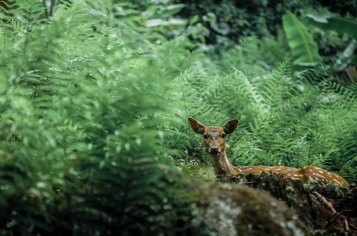
CWP Environmental uses wildlife telemetry to understand and protect animal populations better. Our team uses tracking technology to study the movements and behaviour of wild animals. This technology typically involves attaching a device to an animal, such as a radio transmitter, GPS unit, or satellite tag, which allows our researchers to monitor the animal’s location remotely and other data such as temperature, altitude, and activity levels. Wildlife telemetry can provide valuable insights into the ecology and behaviour of animals, including migration patterns, habitat use, and social interactions.

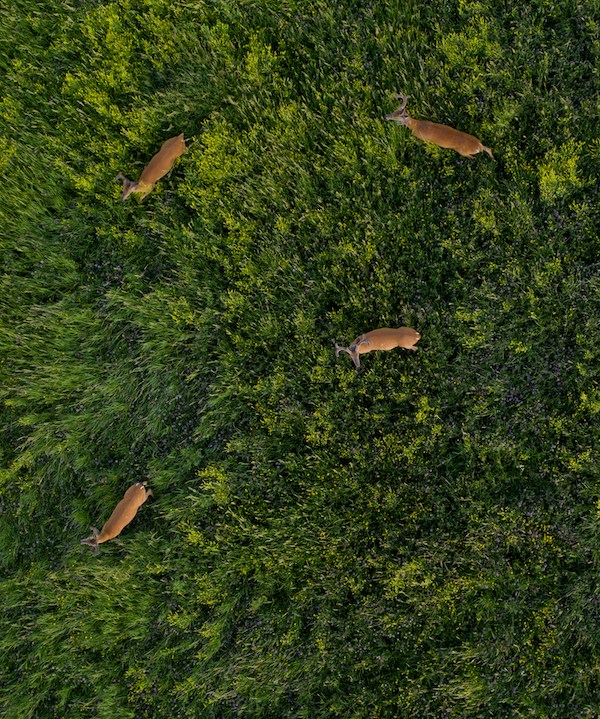
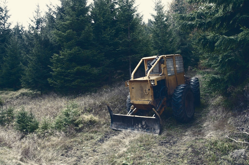
Aerial telemetry refers to the use of wireless communication systems to remotely monitor and control unmanned aerial vehicles (UAVs) or drones. It involves using sensors and communication devices mounted on the drone to transmit data and commands between the drone and a ground station. It allows operators to receive and analyze real-time data from the vehicle, including its location, altitude, speed, fuel levels, temperature, and other important parameters.
Our telemetry system typically includes a radio transmitter on the drone that sends data such as altitude, speed, GPS coordinates, battery status, and other sensor readings to the ground station. The ground station can then display this information on a computer screen or other device in real-time, allowing the operator to monitor the drone’s status and performance.
In addition to monitoring, our aerial telemetry can also be used to control the drone remotely. For example, our operator can use the telemetry system to send commands to the drone, such as adjusting its altitude, changing its heading, or activating specific sensors or cameras. This information can be used to monitor the vehicle’s performance, track its movements, and make decisions about its operations.
Overall, aerial telemetry is a critical technology for the safe and effective operation of drones, allowing operators to monitor and control their vehicles in real-time and improving both the safety and efficiency of drone operations.
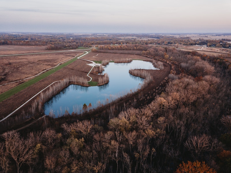
Multi-species distribution surveys are scientific studies that aim to identify and map the spatial distribution of multiple species within a particular ecosystem. The surveys are typically conducted to gain a better understanding of the overall biodiversity of an area and to inform conservation efforts.
The surveys involve collecting data on the presence and abundance of different species across a sampling area. This data can include information on species richness (the number of different species present), density (the number of individuals of each species), and habitat associations (where each species is found within the ecosystem).
There are many different methods that can be used to conduct multi-species distribution surveys, including standardized field surveys, remote sensing techniques (such as aerial or satellite imagery), and genetic surveys (which can be used to identify individual species based on DNA analysis).
Overall, multi-species distribution surveys play an important role in helping us to understand the complexity of ecosystems and to develop strategies for protecting and preserving biodiversity.
Wildlife population inventories refer to the process of assessing the abundance and distribution of various species of wildlife in a particular area. This type of inventory is typically conducted by our wildlife biologist professionals, who use a range of techniques to estimate the number of animals in a given population.
The purpose of conducting wildlife population inventories is to understand the health and status of a particular species or group of species, as well as to gather data on their movements and habitats. This information is used to guide management decisions, such as setting hunting and fishing regulations, determining conservation priorities, and identifying areas that require protection from development or other human activities.
There are a variety of methods that we use to conduct wildlife population inventories. These may include aerial surveys, ground-based observations, mark-and-recapture studies, and the use of remote sensing technologies such as drones
Overall, conducting wildlife population inventories is a critical tool in the conservation and management of wildlife species and is often used to inform conservation.
Wildlife relocation service is often used in situations where wild animals have strayed into urban or suburban areas or where their presence poses a risk to human safety or property.
The process of wildlife relocation typically begins with an assessment of the situation by our trained professionals, who determine the best course of action based on factors such as the species of animal, its behaviour, and the location and extent of the problem. If relocation is deemed necessary and feasible, the animals are captured using humane methods, such as live traps, nets, or tranquillizer darts.
Once the animals have been captured, they are transported to a new location that is deemed suitable for their survival and well-being. This may involve releasing them into a natural habitat that is far from human settlements or into a protected area such as a wildlife sanctuary or national park.
While wildlife relocation can be an effective way of protecting both animals and humans, it is not always the best solution. In some cases, relocating animals can cause stress or disorientation, and it may not be possible to find a suitable new habitat that can support the animal’s needs. Additionally, some species may have a strong homing instinct and may attempt to return to their original location, which can lead to further conflicts with humans.
Overall, wildlife relocation is a complex process that requires careful consideration of a range of factors, and it should only be carried out by trained professionals with the necessary expertise and experience.
A Wildlife impact assessment analyzes the potential effects of a proposed project, development, or activity on wildlife and their habitats. Wildlife impact assessment aims to identify and evaluate a project’s potential impacts on wildlife and develop strategies to mitigate or avoid those impacts.
It is often required by law for projects that have the potential to impact wildlife, and our trained wildlife biologist professionals will carry out the projects.
Our process of wildlife impact assessment typically involves several steps, including:
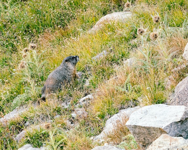
Wildlife tracking surveys are a type of field survey that involves the systematic search for and identification of animal tracks and signs to estimate the presence, abundance, and distribution of wildlife species in a particular area. Wildlife tracking surveys aim to gather information about the ecology and behaviour of wildlife populations and to use this information to inform conservation and management efforts.
Wildlife tracking surveys can be a valuable tool for understanding wildlife populations’ ecology and behaviour and informing conservation and management efforts. However, they require specialized skills and expertise, and our trained wildlife professionals have experience in wildlife tracking and identification.
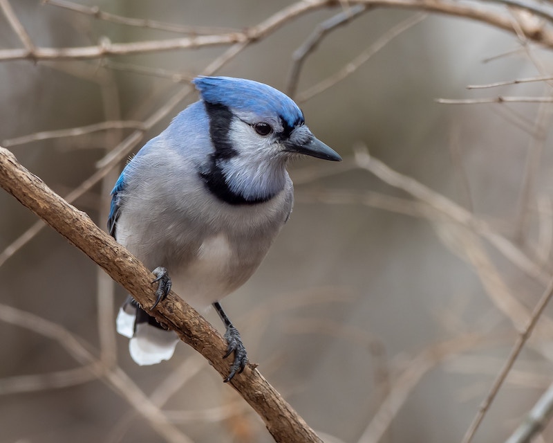
Bird point count services are a type of field survey used to estimate bird populations in a particular area. The goal of bird point count surveys is to gather information about the abundance, distribution, and diversity of bird species, which can be used to inform conservation and management efforts.
Bird point count surveys can be a valuable tool for understanding the ecology and behaviour of bird populations and for informing conservation and management efforts. Our trained wildlife professionals are experienced in bird identification and survey techniques.
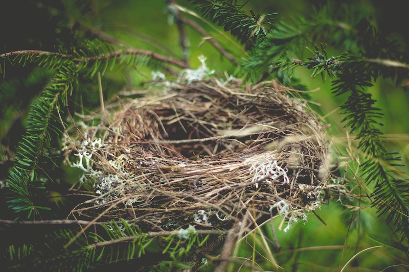
A bird nest survey searches and collects data on bird nests in a specific area or habitat. Our trained staff typically conducts the survey. It is important to note that birds can be found in all types of habitats, including grassy meadows, and due diligence should be taken.
Bird nest surveys are often conducted before construction to identify and protect bird nests that may be present in the area to avoid fines and protect against the decline in bird populations. It’s a crucial step because many bird species are protected under local, provincial and federal laws and regulations. Our staff are very familiar with regulations to ensure your project complies.
If bird nests are found during a survey, the construction project may need to be modified or delayed to avoid disturbing the nesting birds. This may involve adjusting the location or timing of the construction or implementing measures to minimize disturbance to the birds and their nests, such as limiting noise or traffic in the area by laying out a buffer zone. We will determine the size of the zone, which is determined by the species of bird and the type of construction to take place.
By understanding the distribution and abundance of bird species in an area, developers and planners can make informed decisions about managing and protecting natural resources while allowing for development and human activities. In addition, bird nest surveys can help identify important bird habitats and breeding areas, informing conservation efforts and land-use planning. We work with the site with due diligence to ensure the safety and well-being of avian species in areas impacted by the development.
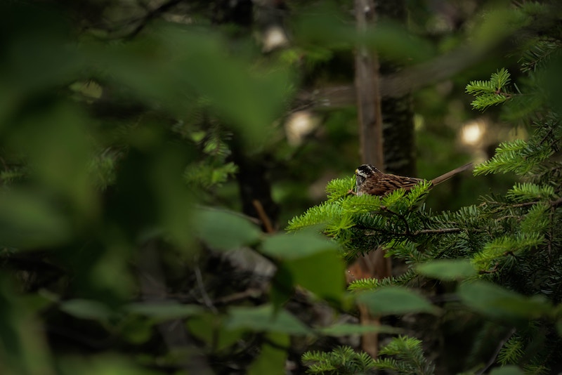
Aves inventory refers to the process of conducting a comprehensive inventory of bird species within a particular geographic area. This inventory typically involves fieldwork, where ornithologists and other experts systematically survey an area to identify and document bird species present. The purpose of an Aves inventory is to gain a better understanding of the bird populations and their distribution within a given area. This information can be used for a variety of purposes, including conservation efforts, habitat management, and scientific research.
To conduct an Aves inventory, our field workers typically use a combination of visual and auditory cues to identify bird species. This may involve listening for distinct bird calls, observing physical characteristics, and noting behaviours such as feeding or nest-building. Once identified, each bird species is documented and recorded in a database or other record-keeping system. This information can then be used for further analysis, such as mapping the distribution of different bird species within the area, or comparing the data with historical records to assess changes in bird populations over time.
Overall, Aves inventory is an important tool for understanding and managing bird populations and can help inform conservation efforts aimed at protecting vulnerable species and preserving important habitats.
Amphibian salvage refers to efforts to rescue and relocate amphibians that are at risk of being harmed or killed due to human activities such as construction, habitat destruction, or pollution. Amphibians, which include frogs, toads, salamanders, and newts, are particularly vulnerable to environmental disturbances due to their sensitive skin, aquatic and terrestrial life stages, and dependence on specific habitats for breeding and feeding.
Amphibian salvage may involve capturing and relocating individual animals or entire populations to safer locations, such as nearby wetlands or protected habitats. This can help to reduce mortality rates and preserve genetic diversity, which is important for maintaining healthy populations and ecosystems.
Amphibian salvage efforts may also involve monitoring and assessing the health and status of populations, as well as implementing measures to mitigate the effects of human activities on amphibian habitats. This may include creating new habitats, restoring degraded habitats, and reducing pollution and other environmental stressors.
Overall, amphibian salvage is an important conservation strategy for protecting these vulnerable and ecologically important animals and ensuring their continued survival in the face of human activities and other threats. Our trained wildlife professionals will provide the service with the utmost care.
To conduct an Aves inventory, our field workers typically use a combination of visual and auditory cues to identify bird species. This may involve listening for distinct bird calls, observing physical characteristics, and noting behaviours such as feeding or nest-building. Once identified, each bird species is documented and recorded in a database or other record-keeping system. This information can then be used for further analysis, such as mapping the distribution of different bird species within the area, or comparing the data with historical records to assess changes in bird populations over time.
Overall, Aves inventory is an important tool for understanding and managing bird populations and can help inform conservation efforts aimed at protecting vulnerable species and preserving important habitats.
Reptiles, including snakes, lizards, turtles, and crocodiles, are often threatened by habitat fragmentation, degradation, and loss, leading to population declines. Reptile salvage refers to the efforts to rescue and relocate reptiles that are at risk of being harmed or killed due to human activities such as construction, habitat destruction, or pollution. CWP Environmental wildlife professionals will professionally and safely relocate the reptiles.
Reptile salvage involves capturing and relocating individual animals or entire populations to safer locations, such as nearby protected habitats or areas with suitable habitats. This can help to reduce mortality rates and preserve genetic diversity, which is important for maintaining healthy populations and ecosystems.
In addition to rescue and relocation efforts, reptile salvage may also involve monitoring and assessing the health and status of populations and implementing measures to mitigate the effects of human activities on reptile habitats. This may include creating new habitats, restoring degraded habitats, and reducing pollution and other environmental stressors.
Overall, reptile salvage is an important conservation strategy for protecting these vulnerable and ecologically important animals and ensuring their continued survival in the face of human activities and other threats.