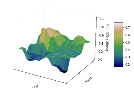
CWP Environmental recognizes the importance of land surveys to map and identify terrain features. With this information, we can provide planning and mitigation for floods, water drainage, watershed management, and new development plans. Our staff are experts in using all necessary surveying equipment delivering expert and reliable results.

The technological advancements of drone technology have allowed Clean Water Pro to expand, providing professional aerial surveying for mineral exploration, wildlife surveys, forestry surveys, fishery surveys, agricultural surveys, mapping and community surveys. With state-of-the-art technology, we offer all your aerial surveillance needs in any terrain.

CWP Environmenal is an expert when it comes to anything water related. Our staff are trained to use a variety of equipment to accurately map the bottom of any water body for assessments, development of bridges and other structures, navigation and dredging. Equipped with the latest, we can precisely map your lake, lagoon, or pond.

At CWP Environmental, we are experienced in conducting biomass surveys for various needs. Staff are experts in categorizing, identifying and evaluating the health and abundance of any ecosystem.
A biomass survey is a scientific study in which the amount of living matter within an ecosystem is estimated. It involves counting and measuring the biomass (the total mass of living organisms) within an area of interest, such as a section of forest or a river.
Biomass surveys can be conducted in different ways, including:
Biomass surveys can provide important information on the health and productivity of ecosystems. They can also help in monitoring changes in biomass over time and in identifying areas that are particularly important for biodiversity and conservation efforts.
© CWP Environmental 2025